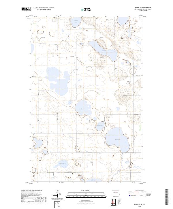
2024 Map of Rangeley SE
USGS Topo · Published 2024About this map
Saint Johns Lutheran Cem and Saint John of Blumenfeld South Cem mark the heritage of German-Russian settlement in this rural portion of McHenry County. The landscape is defined by the prairie pothole region's natural hydrology, featuring an extensive network of basins including Lake Lemer, Bromley Lake, and Long Lake. These water bodies are central to the McHenry County Waterfowl Production Area, which protects critical migratory habitat across several sections of the township. A rigid grid of gravel roads, such as 48th St NE and 11th Ave NE, provides access to the isolated farmsteads and wetlands that characterize this agricultural environment. The presence of Round Lake and Duckshire Lake further illustrates the complex drainage patterns typical of the North Dakota plains.
Find a feature on this map
33 named features on this map. Tap any name to fly to it.
Don’t see what you’re looking for? This feature index may not catch every label — zoom into the map to look around manually.
Map Details
Editions of this 2024 Rangeley SE Map
This is the sole edition of this map. No revisions or reprints were ever made.
Other maps of this area

1930 · Drake
USGS Topo · 1:62,500

1940 · Aylmer
USGS Topo · 1:62,500

1954 · Minot
USGS Topo · 1:250,000

1954 · McClusky
USGS Topo · 1:250,000

1955 · Rangeley NW
USGS Topo · 1:24,000

1955 · Rangeley NE
USGS Topo · 1:24,000

1957 · Rangeley SE
USGS Topo · 1:24,000

1957 · Rangeley
USGS Topo · 1:24,000

1958 · McClusky
USGS Topo · 1:250,000

1958 · Minot
USGS Topo · 1:250,000