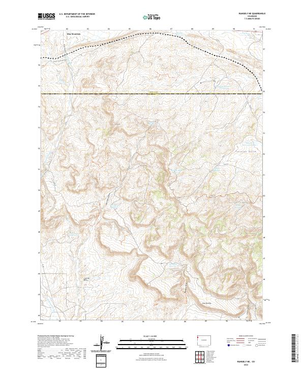
2022 Map of Rangely NE
USGS Topo · Published 2022About this map
Blue Mountain anchors the northern landscape of this Rio Blanco and Moffat County border region, where a complex network of seasonal water management is evident. The terrain is defined by dramatic geological features like the Coal Oil Rim and the deep depression of Coal Oil Basin, suggesting a history of resource exploration or livestock grazing in this arid environment.
Find a feature on this map
32 named features on this map. Tap any name to fly to it.
Don’t see what you’re looking for? This feature index may not catch every label — zoom into the map to look around manually.
Map Details
Editions of this 2022 Rangely NE Map
This is the sole edition of this map. No revisions or reprints were ever made.
Other maps of this area

1907 · Rangely
USGS Topo · 1:125,000

1910 · Rangely
USGS Topo · 1:125,000

1954 · Vernal
USGS Topo · 1:250,000

1958 · Vernal
USGS Topo · 1:250,000

1960 · Vernal
USGS Topo · 1:250,000

1962 · Lazy Y Point
USGS Topo · 1:24,000

1962 · Rangely NE
USGS Topo · 1:24,000
1962 · Rangely
USGS Topo · 1:24,000

1962 · Cactus Reservoir
USGS Topo · 1:24,000
1962 · Mellen Hill
USGS Topo · 1:24,000