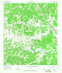
1964 Map of Ranger Creek
USGS Topo · Published 1968About this map
Cibolo Creek and Ranger Creek carve through the dissected plateau of the Texas Hill Country in this mid-1960s survey. The landscape is defined by its water sources and topography, featuring landmarks like Cedar Mountain, Cannon Hill, and the notable Spanish Pass. Settlement is sparse, represented by the small community of Frederick and the Sycamore Ridge Camp, while the Southern Pacific railroad follows the natural corridor of the terrain near Zinke Creek.
Find a feature on this map
28 named features on this map. Tap any name to fly to it.
Don’t see what you’re looking for? This feature index may not catch every label — zoom into the map to look around manually.
Map Details
Editions of this 1964 Ranger Creek Map
2 editions found
Other maps of this area

1953 · Van Raub
USGS Topo · 1:24,000

1954 · San Antonio
USGS Topo · 1:250,000

1956 · Comfort
USGS Topo · 1:62,500

1956 · Medina Lake
USGS Topo · 1:62,500

1957 · Boerne
USGS Topo · 1:62,500

1957 · San Antonio
USGS Topo · 1:250,000

1964 · Comfort
USGS Topo · 1:24,000

1964 · Waring
USGS Topo · 1:24,000
1964 · Sisterdale
USGS Topo · 1:24,000

1964 · Boerne
USGS Topo · 1:24,000