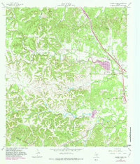
1964 Map of Ranger Creek
USGS Topo · Published 1982About this map
Boerne serves as the primary hub in this Texas Hill Country survey, which captures the area's transition into the early 1980s. The landscape is defined by the winding course of Cibolo Creek and the man-made Boerne Lake, surrounded by prominent terrain features such as Spanish Pass and Cannon Hill. The map meticulously documents the rural infrastructure of the era, from the residential clusters at Frederick and Sycamore Ridge Camp to the industrial presence of several Gravel Pits and a Substation.
Find a feature on this map
33 named features on this map. Tap any name to fly to it.
Don’t see what you’re looking for? This feature index may not catch every label — zoom into the map to look around manually.
Map Details
Editions of this 1964 Ranger Creek Map
2 editions found
Other maps of this area

1953 · Van Raub
USGS Topo · 1:24,000

1954 · San Antonio
USGS Topo · 1:250,000

1956 · Comfort
USGS Topo · 1:62,500

1956 · Medina Lake
USGS Topo · 1:62,500

1957 · Boerne
USGS Topo · 1:62,500

1957 · San Antonio
USGS Topo · 1:250,000

1964 · Comfort
USGS Topo · 1:24,000

1964 · Waring
USGS Topo · 1:24,000
1964 · Sisterdale
USGS Topo · 1:24,000

1964 · Boerne
USGS Topo · 1:24,000