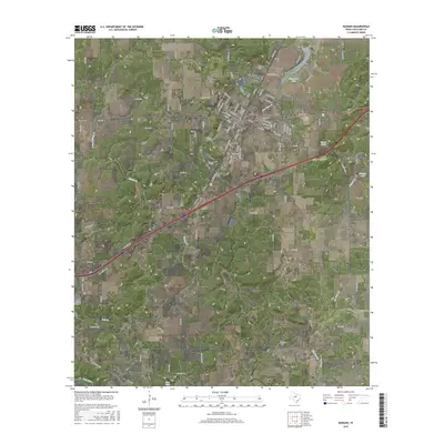
2016 Map of Ranger
USGS Topo · Published 2016About this map
Ranger serves as the central hub of this Eastland County landscape, where the street grid fans out across a terrain defined by the drainage of Palo Pinto Cr and Colony Cr. The town's historical foundations are visible in the proximity of Ranger Coll and the Pioneer Cem near the town center. To the north, the small settlement of Tiffin sits near the shores of Hagaman Lake, while the community of Olden marks the western edge of the survey area. The landscape is dotted with ancestral landmarks, including Evergreen Cem and Cross Bend Cem, which provide significant touchpoints for genealogical research. Water resources like Winsett Spring and the southern reach of the Leon River near Lake Leon influenced the early settlement patterns and agricultural development of this North Central Texas region.
Find a feature on this map
104 named features on this map. Tap any name to fly to it.
Don’t see what you’re looking for? This feature index may not catch every label — zoom into the map to look around manually.
Map Details
Editions of this 2016 Ranger Map
This is the sole edition of this map. No revisions or reprints were ever made.
Other maps of this area

1890 · Breckenridge
USGS Topo · 1:125,000

1894 · Eastland
USGS Topo · 1:125,000

1954 · Abilene
USGS Topo · 1:250,000

1958 · Abilene
USGS Topo · 1:250,000

1966 · Kokomo
USGS Topo · 1:24,000
1966 · Desdemona
USGS Topo · 1:24,000

1966 · Carbon
USGS Topo · 1:24,000
1966 · Bear Mountain
USGS Topo · 1:24,000

1966 · Eastland
USGS Topo · 1:24,000

1966 · Ranger
USGS Topo · 1:24,000