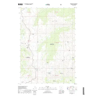
2017 Map of Ranger Peak
USGS Topo · Published 2017About this map
Grand Teton National Park and the Targhee National Forest meet along the high ridgelines of the Wyoming wilderness in this 2017 survey. The landscape is defined by its dramatic verticality, featuring numerous summits such as Ranger Peak, Doane Peak, and Rolling Thunder Mtn. A significant geological event is recorded at the Moose Mountain Slide, while the Teton Crest serves as a primary topographic spine. The drainage network is equally complex, with deep canyons like Webb Canyon and Colter Canyon carrying seasonal meltwater from high-elevation basins. For researchers, the map provides a precise record of the hydrological systems in the backcountry, including Wilderness Falls, Camp Lake, and the headwaters of Berry Cr. This modern data preserves the naming conventions of the peaks and canyons that have guided explorers and park rangers for generations.
Find a feature on this map
40 named features on this map. Tap any name to fly to it.
Don’t see what you’re looking for? This feature index may not catch every label — zoom into the map to look around manually.
Map Details
Editions of this 2017 Ranger Peak Map
This is the sole edition of this map. No revisions or reprints were ever made.
Other maps of this area

1886 · Shoshone
USGS Topo · 1:125,000

1888 · Shoshone
USGS Topo · 1:125,000

1895 · Shoshone
USGS Topo · 1:125,000

1899 · Grand Teton
USGS Topo · 1:125,000

1901 · Shoshone
USGS Topo · 1:125,000

1901 · Grand Teton
USGS Topo · 1:125,000

1908 · Shoshone
USGS Topo · 1:125,000

1911 · Shoshone
USGS Topo · 1:125,000

1955 · Ashton
USGS Topo · 1:250,000

1955 · Driggs
USGS Topo · 1:250,000