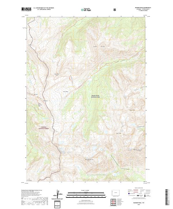
2021 Map of Ranger Peak
USGS Topo · Published 2021About this map
Grand Teton National Park and Targhee National Forest meet at a high mountain divide, creating a landscape defined by dramatic elevation changes and remote basins. This 2021 survey shows a complex network of alpine trails, including the Teton Crest Trl and the Moose Basin Divide Trl, which navigate between prominent summits like Ranger Peak and Doane Peak. The presence of the Moose Mountain Slide north of Moose Mtn indicates active geomorphology in this high-altitude region. Glacial and snow-fed waters collect in high-country basins such as Moose Basin, eventually feeding into Berry Cr and Owl Creek. From the heights of Eagles Rest Peak to the descent into Webb Canyon, the map provides a look at the wilderness corridor that bridges these two major federal land tracts.
Find a feature on this map
44 named features on this map. Tap any name to fly to it.
Don’t see what you’re looking for? This feature index may not catch every label — zoom into the map to look around manually.
Map Details
Editions of this 2021 Ranger Peak Map
This is the sole edition of this map. No revisions or reprints were ever made.
Other maps of this area

1886 · Shoshone
USGS Topo · 1:125,000

1888 · Shoshone
USGS Topo · 1:125,000

1895 · Shoshone
USGS Topo · 1:125,000

1899 · Grand Teton
USGS Topo · 1:125,000

1901 · Shoshone
USGS Topo · 1:125,000

1901 · Grand Teton
USGS Topo · 1:125,000

1908 · Shoshone
USGS Topo · 1:125,000

1911 · Shoshone
USGS Topo · 1:125,000

1955 · Ashton
USGS Topo · 1:250,000

1955 · Driggs
USGS Topo · 1:250,000