
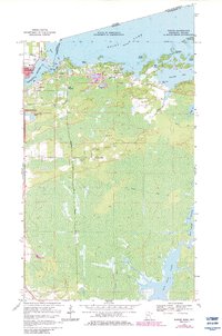
1969 Map of Ranier
USGS Topo · Published 1971About this map
Ranier sits at the northern edge of this Minnesota-Ontario border survey, positioned where the waters of Rainy Lake flow into the Rainy River. The landscape is a intricate network of bays and points, including Sand Bay, Jackfish Bay, and Birch Point, reflecting the watery geography of the Boundary Waters region. Across the international line, the settlement of Fort Frances is visible, linked to the American side by a rail crossing.
Find a feature on this map
34 named features on this map. Tap any name to fly to it.
Don’t see what you’re looking for? This feature index may not catch every label — zoom into the map to look around manually.
Map Details
Editions of this 1969 Ranier Map
2 editions found
Other maps of this area

1919 · International Falls
USGS Topo · 1:62,500

1954 · International Falls
USGS Topo · 1:250,000

1957 · International Falls
USGS Topo · 1:250,000

1958 · International Falls
USGS Topo · 1:250,000

1963 · Ranier
USGS Topo · 1:24,000

1969 · Island View
USGS Topo · 1:24,000

1969 · Ericsburg NW
USGS Topo · 1:24,000

1969 · Ericsburg
USGS Topo · 1:24,000

1969 · Ray
USGS Topo · 1:24,000
1969 · International Falls
USGS Topo · 1:24,000