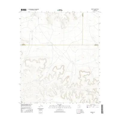
2016 Map of Rankin SE
USGS Topo · Published 2016About this map
The arid ranching country where Upton, Reagan, and Crockett counties meet is defined by a sparse network of essential water sources. In this high desert landscape, artificial water features like Government Tank, Pool Tank, and Lost Tank provide critical infrastructure for livestock and land management. The northern terrain is marked by Lake Titsworth and the drainage of Noelke Creek, which cuts through the plateau. Local transit is limited to unpaved ranch roads such as Vandevanter and Co RD 220, illustrating the expansive and isolated nature of the West Texas divide. This survey documents the intersection of three counties in a region where geography is primarily dictated by topography and the location of reliable water.
Find a feature on this map
10 named features on this map. Tap any name to fly to it.
Don’t see what you’re looking for? This feature index may not catch every label — zoom into the map to look around manually.
Map Details
Editions of this 2016 Rankin SE Map
This is the sole edition of this map. No revisions or reprints were ever made.
Other maps of this area

1928 · Rankin
USGS Topo · 1:125,000

1929 · Sheffield
USGS Topo · 1:125,000

1954 · Sonora
USGS Topo · 1:250,000

1954 · San Angelo
USGS Topo · 1:250,000

1958 · Sonora
USGS Topo · 1:250,000

1958 · San Angelo
USGS Topo · 1:250,000

1965 · San Angelo
USGS Topo · 1:250,000

1967 · Twelvemile Camp
USGS Topo · 1:24,000
1967 · Iraan
USGS Topo · 1:24,000
1967 · Owens Creek NW
USGS Topo · 1:24,000