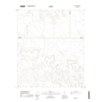
2019 Map of Rankin SE
USGS Topo · Published 2019About this map
Lake Titsworth sits in the northwest corner of this West Texas landscape, where the borders of Upton, Reagan, and Crockett counties meet. The terrain is defined by a complex network of dry washes and ephemeral drainage patterns, most notably Noelke Cr, which winds through the central and eastern portions of the quadrangle. This area reflects the essential water management of the Permian Basin's ranching country, evidenced by scattered livestock watering points such as Government Tank, Pool Tank, and Lost Tank. Access to this remote rangeland is provided by local routes like Van Devanter and Co Rd 220, which navigate the high mesas and deep draws characteristic of the Edwards Plateau's western edge.
Find a feature on this map
10 named features on this map. Tap any name to fly to it.
Don’t see what you’re looking for? This feature index may not catch every label — zoom into the map to look around manually.
Map Details
Editions of this 2019 Rankin SE Map
This is the sole edition of this map. No revisions or reprints were ever made.
Other maps of this area

1928 · Rankin
USGS Topo · 1:125,000

1929 · Sheffield
USGS Topo · 1:125,000

1954 · Sonora
USGS Topo · 1:250,000

1954 · San Angelo
USGS Topo · 1:250,000

1958 · Sonora
USGS Topo · 1:250,000

1958 · San Angelo
USGS Topo · 1:250,000

1965 · San Angelo
USGS Topo · 1:250,000

1967 · Twelvemile Camp
USGS Topo · 1:24,000
1967 · Iraan
USGS Topo · 1:24,000
1967 · Owens Creek NW
USGS Topo · 1:24,000