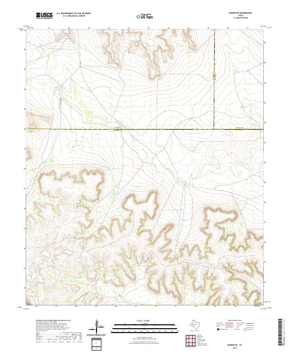
2022 Map of Rankin SE
USGS Topo · Published 2022About this map
Lake Titsworth sits near the northern edge of this high-plateau landscape where the borders of Upton, Reagan, and Crockett counties converge. The terrain is defined by deep, sinuous draws and arroyos, including the drainage of Noelke Cr, which cuts across the central portion of the quadrangle. This semi-arid ranching country relies on essential water catchments such as Government Tank, Pool Tank, and Lost Tank to manage the sparse resources of the West Texas interior. Infrastructure is minimal, consisting of a few established routes like Co Rd 220 and the remote Vandevanter road, reflecting a sparsely populated region dedicated largely to land management and cattle raising.
Find a feature on this map
10 named features on this map. Tap any name to fly to it.
Don’t see what you’re looking for? This feature index may not catch every label — zoom into the map to look around manually.
Map Details
Editions of this 2022 Rankin SE Map
This is the sole edition of this map. No revisions or reprints were ever made.
Other maps of this area

1928 · Rankin
USGS Topo · 1:125,000

1929 · Sheffield
USGS Topo · 1:125,000

1954 · Sonora
USGS Topo · 1:250,000

1954 · San Angelo
USGS Topo · 1:250,000

1958 · Sonora
USGS Topo · 1:250,000

1958 · San Angelo
USGS Topo · 1:250,000

1965 · San Angelo
USGS Topo · 1:250,000

1967 · Twelvemile Camp
USGS Topo · 1:24,000
1967 · Iraan
USGS Topo · 1:24,000
1967 · Owens Creek NW
USGS Topo · 1:24,000