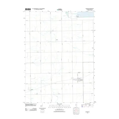
2012 Map of Ransom
USGS Topo · Published 2012About this map
Ransom and the smaller community of Kernan anchor this portion of the LaSalle County landscape, where the rectilinear grid of country roads defines the agricultural character of north-central Illinois. The map captures a transition from the quiet drainages of Otter Cr and Waupecan Cr to the massive industrial and environmental footprint of La Salle Lake and the adjacent LaSalle Fish Hatchery in the northeast. Genealogists will find significant local value in the distribution of family and parish burial grounds, including the Saint Patrick's Catholic Cem, Hegland Cem, Allen Cem, and Funk Cem. While the village of Ransom shows a traditional street plan featuring E Plumb St and E Roosevelt St, the surrounding acreage remains dominated by open fields and small airfields like Egland Field.
Find a feature on this map
39 named features on this map. Tap any name to fly to it.
Don’t see what you’re looking for? This feature index may not catch every label — zoom into the map to look around manually.
Map Details
Editions of this 2012 Ransom Map
This is the sole edition of this map. No revisions or reprints were ever made.
Other maps of this area

1892 · Marseilles
USGS Topo · 1:62,500

1892 · Ottawa
USGS Topo · 1:62,500

1915 · Ottawa
USGS Topo · 1:62,500

1916 · Marseilles
USGS Topo · 1:62,500

1925 · Streator
USGS Topo · 1:62,500

1927 · Streator
USGS Topo · 1:62,500

1940 · Marseilles
USGS Topo · 1:62,500

1946 · Ottawa
USGS Topo · 1:62,500

1958 · Odell
USGS Topo · 1:62,500

1958 · Aurora
USGS Topo · 1:250,000