2024 Map of Ransom
USGS Topo · Published 2024About this map
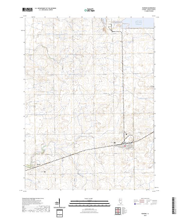
Ransom serves as the primary municipal center in this section of LaSalle County, Illinois, organized around a traditional grid of streets including Campbell St and Roosevelt St. The surrounding agricultural landscape is defined by a dense network of county highways and section roads, such as Co HWY 15 and N 16th Rd, that carve through the prairie. Waterways like Otter Creek and Waupecan Creek meander across the terrain, while the massive LaSalle County Nuclear Station Cooling Pond dominates the northeastern corner, indicating the modern industrial character of the region. Local heritage is preserved in several rural burial grounds, including Saint Patrick's Catholic Cem and Allen Cem, which sit just outside the main village. To the southwest, the smaller settlement of Kernan anchors the rural community near the banks of Otter Creek.
Find a feature on this map
38 named features on this map. Tap any name to fly to it.
Don’t see what you’re looking for? This feature index may not catch every label — zoom into the map to look around manually.
Map Details
Editions of this 2024 Ransom Map
This is the sole edition of this map. No revisions or reprints were ever made.