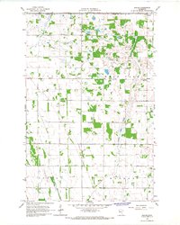
1966 Map of Ranum
USGS Topo · Published 1967About this map
The agricultural landscape of Sundal, Bear Park, Strand, and Waukon townships is defined by a grid of farmsteads and field lines in the mid-1960s. This survey, conducted by the U.S. Geological Survey in cooperation with the Minnesota Department of Administration, highlights the rural character of eastern Norman and Polk counties. Small clusters of activity are centered around Ranum, Rindal, and Sundal, while the drainage of the land is managed through features like County Ditch No 42 and the natural course of Garden Slough. Cultural landmarks are prominently marked, including St Johns Ch, Sundal Ch, and Ness Ch, which served the local farming community. The map also records early industrial activity, such as a Gravel Pit used for local road infrastructure, providing a detailed view of these high-plains townships before modern consolidation.
Find a feature on this map
14 named features on this map. Tap any name to fly to it.
Don’t see what you’re looking for? This feature index may not catch every label — zoom into the map to look around manually.
Map Details
Editions of this 1966 Ranum Map
This is the sole edition of this map. No revisions or reprints were ever made.
Other maps of this area

1918 · Twin Valley
USGS Topo · 1:62,500

1919 · Valley
USGS Topo · 1:62,500

1952 · Grand Forks
USGS Topo · 1:250,000

1956 · Grand Forks
USGS Topo · 1:250,000

1965 · Fertile
USGS Topo · 1:24,000

1965 · Waukon
USGS Topo · 1:24,000

1965 · Twin Valley
USGS Topo · 1:24,000

1965 · Flaming
USGS Topo · 1:24,000

1966 · Grand Forks
USGS Topo · 1:250,000
1966 · Halverson Lake
USGS Topo · 1:24,000