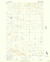
1956 Map of Rapelje
USGS Topo · Published 1993About this map
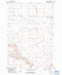
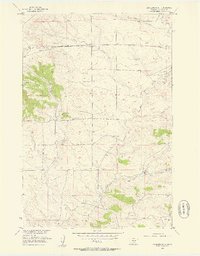
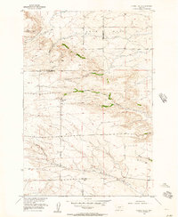
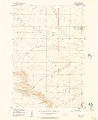
The settlement of Rapelje anchors this mid-century look at the Montana plains, situated where the high country begins to break into the Lake Basin. This area, surveyed in the 1950s, reveals a landscape defined by its water sources and topography, from the drainage of Sixshooter Creek to the seasonal courses of Middle Creek and Cedar Creek. Local history and genealogy researchers will find the Rapelje Cem south of town, alongside several family-named landmarks such as Hugh Henry Hill and Jones Hill. The presence of a Strip Mine and Gravel Pit indicates early industrial activity, while more remote outposts like Busteed and Mc Nally mark the extent of local ranching and settlement. The varied terrain of Gurney Gulch and Gurney Creek further illustrates the complex drainage patterns that shaped the early development of this portion of Stillwater County.
Find a feature on this map
19 named features on this map. Tap any name to fly to it.
Don’t see what you’re looking for? This feature index may not catch every label — zoom into the map to look around manually.
Map Details
Editions of this 1956 Rapelje Map
2 editions found
Other maps of this area

1889 · Big Snowy Mountain
USGS Topo · 1:250,000

1892 · Stillwater
USGS Topo · 1:125,000

1893 · Big Snowy Mountain
USGS Topo · 1:250,000

1954 · Billings
USGS Topo · 1:250,000

1954 · Roundup
USGS Topo · 1:250,000
1955 · Antelope Point
USGS Topo · 1:24,000
1955 · Russell Gulch
USGS Topo · 1:24,000
1956 · Rapelje
USGS Topo · 1:24,000
1956 · Battle Butte
USGS Topo · 1:24,000
1956 · Lindemulder Hill
USGS Topo · 1:24,000