
1903 Map of Rapid
USGS Topo · Published 1903About this map
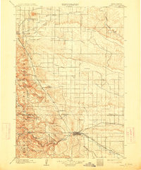
Rapid serves as the gateway to the Black Hills Forest Reserve at the turn of the century, positioned where the hills meet the plains. The landscape is defined by the heavy presence of the Fort Meade Military Reservation and the sprawling Fort Meade outpost in the north. Settlement and industry follow the path of the Fremont Elkhorn and Missouri Valley railroad, which links towns like Tilford, Piedmont, and Blackhawk along the eastern edge of the mountains. Early resource extraction and local commerce are evident through features like Pratts Mill and the Doc Done Ranch. The map also captures significant institutional sites of the era, such as the Indian School located just outside the growing center of Rapid. Waterways such as Rapid Creek and the Belle Fourche River provide the necessary drainage for this complex terrain of gulches and buttes, including the prominent Bear Butte.
Find a feature on this map
36 named features on this map. Tap any name to fly to it.
Don’t see what you’re looking for? This feature index may not catch every label — zoom into the map to look around manually.
Map Details
Editions of this 1903 Rapid Map
4 editions found
Other maps of this area

1893 · Rapid
USGS Topo · 1:125,000

1894 · Deadwood
USGS Topo · 1:125,000

1894 · Hermosa
USGS Topo · 1:125,000

1896 · Harney Peak
USGS Topo · 1:125,000

1898 · Rapid
USGS Topo · 1:125,000

1899 · Sturgis
USGS Topo · 1:62,500

1901 · Hermosa
USGS Topo · 1:125,000

1901 · Harney Peak
USGS Topo · 1:125,000

1901 · Deadwood
USGS Topo · 1:125,000

1905 · Saint Onge
USGS Topo · 1:62,500