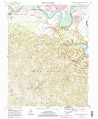
1994 Map of Rappahannock Academy
USGS Topo · Published 1997About this map
The Rappahannock River carves a deep horseshoe bend around Skinkers Neck and Slinkeys Neck, defining the northern border of this Virginia landscape. This region is characterized by its numerous small, family-named corners and crossroads, such as Olney Corner, Pullers Corner, and Eubank Corner, suggesting a deeply rooted rural social structure. Central to the map's geography is the large expanse of the Fort A P Hill Military Reservation, which encompasses numerous former homestead sites and local landmarks like Bethesda Church and Travis Mill. The inclusion of the USGS Geomagnetic Center and Moss Neck Airstrip highlights a specialized 20th-century technical and aviation layer overlaid upon the traditional riverfront wharves like Hayfield Wharf and Moons Mount Wharf.
Find a feature on this map
65 named features on this map. Tap any name to fly to it.
Don’t see what you’re looking for? This feature index may not catch every label — zoom into the map to look around manually.
Map Details
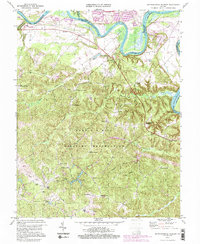
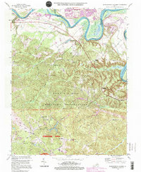
Editions of this 1994 Rappahannock Academy Map
3 editions found
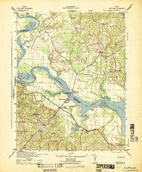
Other maps of this area

1889 · Fredericksburg
USGS Topo · 1:125,000

1892 · Fredericksburg
USGS Topo · 1:125,000

1894 · Fredericksburg
USGS Topo · 1:125,000

1926 · Stafford
USGS Topo · 1:62,500

1931 · Stafford
USGS Topo · 1:62,500

1942 · Bowling Green
USGS Topo · 1:31,680

1942 · Upper Zion
USGS Topo · 1:31,680

1942 · Woodford
USGS Topo · 1:31,680

1942 · Guinea
USGS Topo · 1:31,680
1942 · Port Royal
USGS Topo · 1:31,680