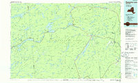
1985 Map of Raquette Lake
USGS Topo · Published 1986About this map
The vast interior of the Adirondack Park is detailed here through a landscape of expansive waterways and high-elevation peaks during the mid-1980s. Centered on the intricate shoreline of Raquette Lake, the map traces the early recreational and timber corridors of the central Adirondacks, including the Adirondack RR and Delaware & Hudson RR. Key settlements such as Old Forge, Blue Mountain Lake, and Indian Lake serve as anchors within a region defined by its hydrography, from the headwaters of the Hudson River to the Stillwater Reservoir and the Fulton Chain Lakes.
Find a feature on this map
392 named features on this map. Tap any name to fly to it.
Don’t see what you’re looking for? This feature index may not catch every label — zoom into the map to look around manually.
Map Details
Editions of this 1985 Raquette Lake Map
2 editions found
Other maps of this area

1895 · North Creek
USGS Topo · 1:62,500

1895 · Mt. Marcy
USGS Topo · 1:62,500

1897 · North Creek
USGS Topo · 1:62,500

1897 · Schroon Lake
USGS Topo · 1:62,500

1897 · Remsen
USGS Topo · 1:62,500

1898 · Newcomb
USGS Topo · 1:62,500

1898 · Thirteenth Lake
USGS Topo · 1:62,500

1899 · Indian Lake
USGS Topo · 1:62,500

1900 · Remsen
USGS Topo · 1:62,500

1900 · Canada Lake
USGS Topo · 1:62,500