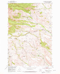
1951 Map of Raspberry Butte
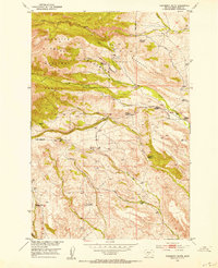
USGS Topo · Published 1976About this map
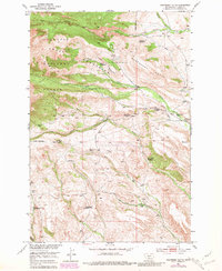
The Gallatin Crazy Mountains define this high-altitude landscape, where the Gallatin National Forest transitions into cattle ranching and homesteading territory. Mapping based on 1948 aerial photography and 1951 field checks reveals a network of mountain drainages, including the South Fork Big Timber Creek and Little Timber Creek, which sustained early 20th-century settlers.
Find a feature on this map
30 named features on this map. Tap any name to fly to it.
Don’t see what you’re looking for? This feature index may not catch every label — zoom into the map to look around manually.
Map Details
Editions of this 1951 Raspberry Butte Map
3 editions found
Other maps of this area

1886 · Little Belt Mts.
USGS Topo · 1:250,000

1891 · Livingston
USGS Topo · 1:250,000

1893 · Livingston
USGS Topo · 1:250,000

1894 · Little Belt Mts.
USGS Topo · 1:250,000

1897 · Little Belt Mts.
USGS Topo · 1:250,000

1898 · Little Belt Mts.
USGS Topo · 1:250,000

1902 · Little Belt Mts.
USGS Topo · 1:250,000

1947 · Bozeman
USGS Topo · 1:250,000

1948 · Bozeman
USGS Topo · 1:250,000

1948 · White Sulphur Springs
USGS Topo · 1:250,000