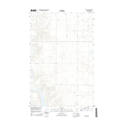
2014 Map of Rat Lake
USGS Topo · Published 2014About this map
The White Earth River carves a deep valley through the northern High Plains of McKenzie County, winding south toward its confluence with the Missouri River. This 2014 survey documents the dramatic transition from the high, grid-patterned agricultural plateaus to the flooded landscape of the Missouri River valley. The massive expanse of Lake Sakakawea dominates the southern portion of the map, submerging the historic river channel and creating an intricate shoreline along the bluffs. Inland from the river, the landscape is punctuated by prairie potholes and depressions, including the small body of water known as Rat Lake. A network of rural section-line roads, such as 94th Ave NW and 51st St NW, provides access across the upland plains, illustrating the enduring township-and-range surveying system that defines the region's movement and land use.
Find a feature on this map
12 named features on this map. Tap any name to fly to it.
Don’t see what you’re looking for? This feature index may not catch every label — zoom into the map to look around manually.
Map Details
Editions of this 2014 Rat Lake Map
This is the sole edition of this map. No revisions or reprints were ever made.
Other maps of this area

1953 · Williston
USGS Topo · 1:250,000

1957 · Williston
USGS Topo · 1:250,000

1965 · Charlson
USGS Topo · 1:24,000

1965 · Charlson NE
USGS Topo · 1:24,000

1979 · Tioga SE
USGS Topo · 1:24,000

1981 · Robinson Lake
USGS Topo · 1:24,000
1981 · Rat Lake SE
USGS Topo · 1:24,000

1981 · Ross
USGS Topo · 1:24,000

1981 · Manitou
USGS Topo · 1:24,000
1981 · Rat Lake
USGS Topo · 1:24,000