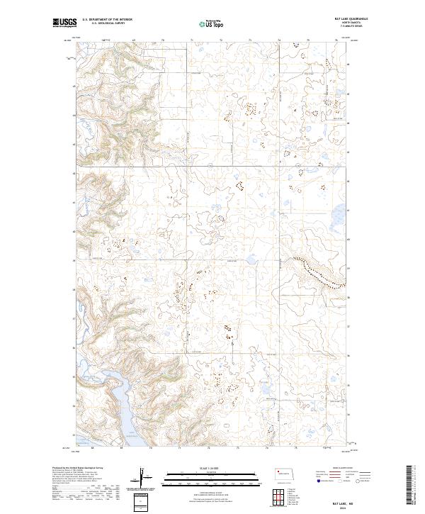
2024 Map of Rat Lake
USGS Topo · Published 2024About this map
Lake Sakakawea dominates the southern reaches of this landscape, its expansive waters contrasting with the dissected bluffs and coulees of the north. The area is defined by the winding course of the White Earth River, which carves through the terrain toward the reservoir. On the higher plains to the east, the Mountrail County Waterfowl Production Area and Rat Lake highlight a region of prairie potholes and wetlands typical of this part of North Dakota. A sparse network of township roads, such as 57th St NW and 94th Ave NW, grid the landscape, providing access to the sectioned ranchlands and conservation areas that characterize the modern rural geography of Mountrail County.
Find a feature on this map
19 named features on this map. Tap any name to fly to it.
Don’t see what you’re looking for? This feature index may not catch every label — zoom into the map to look around manually.
Map Details
Editions of this 2024 Rat Lake Map
This is the sole edition of this map. No revisions or reprints were ever made.
Other maps of this area

1953 · Williston
USGS Topo · 1:250,000

1957 · Williston
USGS Topo · 1:250,000

1965 · Charlson
USGS Topo · 1:24,000

1965 · Charlson NE
USGS Topo · 1:24,000

1979 · Tioga SE
USGS Topo · 1:24,000

1981 · Robinson Lake
USGS Topo · 1:24,000
1981 · Rat Lake SE
USGS Topo · 1:24,000

1981 · Ross
USGS Topo · 1:24,000

1981 · Manitou
USGS Topo · 1:24,000
1981 · Rat Lake
USGS Topo · 1:24,000