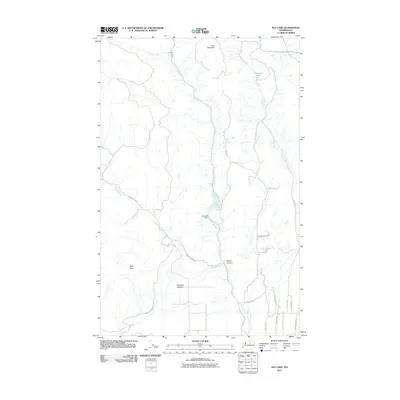
2011 Map of Rat Lake
USGS Topo · Published 2011About this map
Whitestone Creek and Swamp Creek define the drainage patterns of this high-elevation landscape in Okanogan County. The terrain is characterized by prominent peaks like Dent Mountain and Bald Knob, while water management is anchored by the Rat Lake Dam and its namesake reservoir. A sparse network of mountain roads, including Sines Rd and Paradise Hill Rd, connects the small settlement at Harmony Heights with the surrounding canyons. This 2011 survey captures the area's rural character and rugged geography, showing how transportation routes like the Hanford Cutoff and County Hwy 1703 navigate the complex topography between Rowel Canyon and Rat Lake. Researchers can trace the development of small-scale infrastructure and the proximity of seasonal lakes such as Rowel Lake and Starzman Lake to established land parcels.
Find a feature on this map
30 named features on this map. Tap any name to fly to it.
Don’t see what you’re looking for? This feature index may not catch every label — zoom into the map to look around manually.
Map Details
Editions of this 2011 Rat Lake Map
This is the sole edition of this map. No revisions or reprints were ever made.
Other maps of this area

1905 · Okanogan
USGS Topo · 1:125,000

1954 · Okanogan
USGS Topo · 1:250,000

1956 · Loup Loup
USGS Topo · 1:62,500

1957 · Okanogan
USGS Topo · 1:62,500

1957 · Bridgeport
USGS Topo · 1:62,500

1957 · Brewster
USGS Topo · 1:62,500

1958 · Okanogan
USGS Topo · 1:250,000
1980 · Bridgeport
USGS Topo · 1:24,000
1980 · Monse
USGS Topo · 1:24,000
1981 · Malott
USGS Topo · 1:24,000