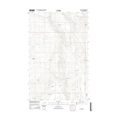
2014 Map of Rat Lake
USGS Topo · Published 2014About this map
Harmony Heights sits atop the high plateaus of Okanogan County, overlooking a network of drainages and seasonal water bodies that characterize this part of north-central Washington. The terrain is marked by prominent high points such as Dent Mtn and Paradise Hill, while the drainage system of Swamp Cr and Whitestone Cr flows through deep incisions like Rowel Canyon. Centrally located, Rat Lake and the smaller Storzman Lake provide focal points in an otherwise arid landscape.
Find a feature on this map
34 named features on this map. Tap any name to fly to it.
Don’t see what you’re looking for? This feature index may not catch every label — zoom into the map to look around manually.
Map Details
Editions of this 2014 Rat Lake Map
This is the sole edition of this map. No revisions or reprints were ever made.
Other maps of this area

1905 · Okanogan
USGS Topo · 1:125,000

1954 · Okanogan
USGS Topo · 1:250,000

1956 · Loup Loup
USGS Topo · 1:62,500

1957 · Okanogan
USGS Topo · 1:62,500

1957 · Bridgeport
USGS Topo · 1:62,500

1957 · Brewster
USGS Topo · 1:62,500

1958 · Okanogan
USGS Topo · 1:250,000
1980 · Bridgeport
USGS Topo · 1:24,000
1980 · Monse
USGS Topo · 1:24,000
1981 · Malott
USGS Topo · 1:24,000