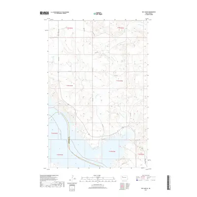
2017 Map of Rat Lake SE
USGS Topo · Published 2017About this map
Lake Sakakawea dominates the southwestern corner of this landscape, its expansive shoreline defining the border between McKenzie and Mountrail Counties. The interior terrain is shaped by the winding course of the Little Knife River, which snakes through the central and eastern sections of the quadrangle. This 2017 survey reflects the systematic grid of the Public Land Survey System, with township and range lines such as t153n r92w carving the prairie into distinct sections. A network of rural section roads, including 92nd Ave NW and 48th St NW, provides access across the upland plains above the river valley. The map documents a sparsely settled agricultural and water-managed region of North Dakota during the early 21st century, showing how modern transportation routes like 42 St NW navigate the complex topography leading down to the reservoir.
Find a feature on this map
19 named features on this map. Tap any name to fly to it.
Don’t see what you’re looking for? This feature index may not catch every label — zoom into the map to look around manually.
Map Details
Editions of this 2017 Rat Lake SE Map
This is the sole edition of this map. No revisions or reprints were ever made.
Other maps of this area

1953 · Williston
USGS Topo · 1:250,000

1953 · Watford City
USGS Topo · 1:250,000

1957 · Williston
USGS Topo · 1:250,000

1957 · Watford City
USGS Topo · 1:250,000

1967 · Watford City
USGS Topo · 1:250,000

1967 · Sanish NW
USGS Topo · 1:24,000

1967 · Sanish
USGS Topo · 1:24,000

1981 · Belden SW
USGS Topo · 1:24,000

1981 · Robinson Lake
USGS Topo · 1:24,000

1981 · New Town
USGS Topo · 1:24,000