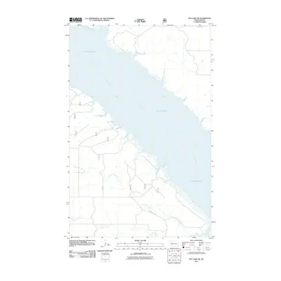
2011 Map of Rat Lake SW
USGS Topo · Published 2011About this map
Lake Sakakawea and the winding course of the Missouri River dominate this landscape within McKenzie County. This 2011 survey illustrates the complex, indented shoreline of the reservoir as it meets the drainage systems of Little Antelope Creek and Antelope Creek from the south and west. The map reflects a modern rural infrastructure defined by both named and numbered forest and county routes, including County Rte 6 and various numbered service roads like 882 and 875. The terrain is characterized by the stark contrast between the vast open water of the lake and the intricate coulees and breaks formed by the seasonal creek beds, providing a detailed record of the shoreline and access roads in the early 21st century.
Find a feature on this map
16 named features on this map. Tap any name to fly to it.
Don’t see what you’re looking for? This feature index may not catch every label — zoom into the map to look around manually.
Map Details
Editions of this 2011 Rat Lake SW Map
This is the sole edition of this map. No revisions or reprints were ever made.
Other maps of this area

1953 · Williston
USGS Topo · 1:250,000

1953 · Watford City
USGS Topo · 1:250,000

1957 · Williston
USGS Topo · 1:250,000

1957 · Watford City
USGS Topo · 1:250,000

1965 · Charlson
USGS Topo · 1:24,000

1965 · Blue Buttes
USGS Topo · 1:24,000

1965 · Charlson NE
USGS Topo · 1:24,000

1967 · Watford City
USGS Topo · 1:250,000

1967 · Sanish NW
USGS Topo · 1:24,000

1967 · Sanish
USGS Topo · 1:24,000