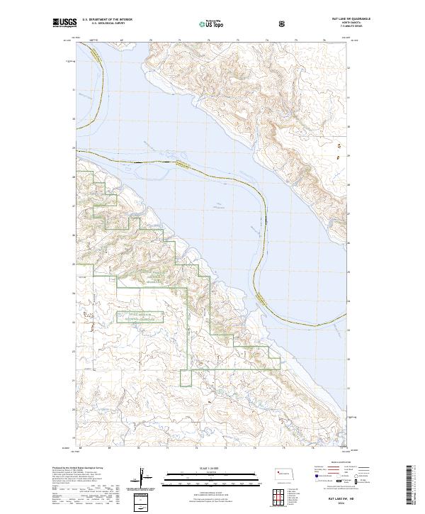
2024 Map of Rat Lake SW
USGS Topo · Published 2024About this map
Little Missouri National Grassland dominates the western landscape of this North Dakota quadrangle, where the rugged breaks of the Badlands meet the expansive waters of Lake Sakakawea. This modern survey illustrates the current path of the Missouri River as it enters the reservoir, marking the boundary between McKenzie and Mountrail counties. The terrain is defined by complex contouring and drainage systems, most notably Antelope Creek which carves through the southern sections. Local infrastructure is sparse, characterized by gravel section-line roads such as 44 St NW and 38 Ave NW that provide access to this remote ranching and conservation area. The map serves as a precise record of the shoreline and public land boundaries within the Williston Basin region.
Find a feature on this map
15 named features on this map. Tap any name to fly to it.
Don’t see what you’re looking for? This feature index may not catch every label — zoom into the map to look around manually.
Map Details
Editions of this 2024 Rat Lake SW Map
This is the sole edition of this map. No revisions or reprints were ever made.
Other maps of this area

1953 · Williston
USGS Topo · 1:250,000

1953 · Watford City
USGS Topo · 1:250,000

1957 · Williston
USGS Topo · 1:250,000

1957 · Watford City
USGS Topo · 1:250,000

1965 · Charlson
USGS Topo · 1:24,000

1965 · Blue Buttes
USGS Topo · 1:24,000

1965 · Charlson NE
USGS Topo · 1:24,000

1967 · Watford City
USGS Topo · 1:250,000

1967 · Sanish NW
USGS Topo · 1:24,000

1967 · Sanish
USGS Topo · 1:24,000