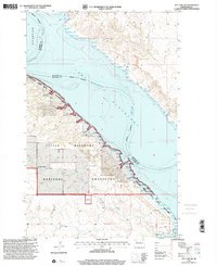
1997 Map of Rat Lake SW
USGS Topo · Published 2001About this map
Lake Sakakawea and the winding course of the Missouri River dominate this West River landscape at the end of the twentieth century. This survey documents a complex intersection of water and land management, where the Little Missouri National Grassland meets the Antelope Creek State Game Management Area along the rugged breaks of the Little Missouri River. A mix of public lands and private holdings is evident, with named sites such as the M Bohmbach Ranch and the locality of Crow Flies High providing specific touchpoints for local historians. From the expansive White Earth Bay in the north to the lower reaches of Antelope Creek, the topography captures the transition between the rolling high plains and the deeply eroded drainage systems that define the McKenzie and Mountrail county lines.
Find a feature on this map
15 named features on this map. Tap any name to fly to it.
Don’t see what you’re looking for? This feature index may not catch every label — zoom into the map to look around manually.
Map Details
Editions of this 1997 Rat Lake SW Map
This is the sole edition of this map. No revisions or reprints were ever made.
Other maps of this area

1953 · Williston
USGS Topo · 1:250,000

1953 · Watford City
USGS Topo · 1:250,000

1957 · Williston
USGS Topo · 1:250,000

1957 · Watford City
USGS Topo · 1:250,000

1965 · Charlson
USGS Topo · 1:24,000

1965 · Blue Buttes
USGS Topo · 1:24,000

1965 · Charlson NE
USGS Topo · 1:24,000

1967 · Watford City
USGS Topo · 1:250,000

1967 · Sanish NW
USGS Topo · 1:24,000

1967 · Sanish
USGS Topo · 1:24,000