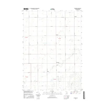
2017 Map of Rathbone
USGS Topo · Published 2017About this map
The agricultural landscape of Gratiot County is defined here by the headwaters and tributaries of several prominent local waterways. Small rural settlements like Edgewood and Sickles anchor the southern portion of the township, while Rathbone and Langport sit further north. The terrain is crisscrossed by a rigid grid of country roads, including E Van Buren Rd and N Barry Rd, which separate extensive farm plots. This section of Michigan is notably hydrologically complex, featuring the Bad River and its various offshoots such as the Huckleberry Drain and Beaver Cr. Genealogists may find particular interest in landmarks like the Lafayette Cem and Hamilton Ch, which serve as long-standing focal points for the surrounding rural community. The map also traces several smaller streams, including Shad Cr, Brady Cr, and Potato Cr, which illustrate the natural drainage patterns of the region.
Find a feature on this map
43 named features on this map. Tap any name to fly to it.
Don’t see what you’re looking for? This feature index may not catch every label — zoom into the map to look around manually.
Map Details
Editions of this 2017 Rathbone Map
This is the sole edition of this map. No revisions or reprints were ever made.
Other maps of this area

1918 · Elsie
USGS Topo · 1:62,500

1918 · Perrinton
USGS Topo · 1:62,500

1934 · Merrill
USGS Topo · 1:62,500

1935 · Alma
USGS Topo · 1:62,500

1937 · Merrill
USGS Topo · 1:62,500

1938 · Alma
USGS Topo · 1:62,500

1943 · Perrinton
USGS Topo · 1:62,500

1943 · Elsie
USGS Topo · 1:62,500

1954 · Midland
USGS Topo · 1:250,000

1958 · Midland
USGS Topo · 1:250,000