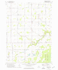
1973 Map of Rathbone
USGS Topo · Published 1977About this map
Agricultural fields and rural townships define the landscape of central Michigan in the early 1970s, as seen through this detailed topographic record. The map reveals a network of country roads like Van Buren Road and Washington Road connecting small crossroads communities and family homesteads. Cultural landmarks such as Lafayette Ch and Emerson Ch serve as local anchors, while the Hamilton Cem and Lafayette Cem provide critical data points for genealogists researching the area's rural history.
Find a feature on this map
33 named features on this map. Tap any name to fly to it.
Don’t see what you’re looking for? This feature index may not catch every label — zoom into the map to look around manually.
Map Details
Editions of this 1973 Rathbone Map
This is the sole edition of this map. No revisions or reprints were ever made.
Other maps of this area

1918 · Elsie
USGS Topo · 1:62,500

1918 · Perrinton
USGS Topo · 1:62,500

1934 · Merrill
USGS Topo · 1:62,500

1935 · Alma
USGS Topo · 1:62,500

1937 · Merrill
USGS Topo · 1:62,500

1938 · Alma
USGS Topo · 1:62,500

1943 · Perrinton
USGS Topo · 1:62,500

1943 · Elsie
USGS Topo · 1:62,500

1954 · Midland
USGS Topo · 1:250,000

1958 · Midland
USGS Topo · 1:250,000