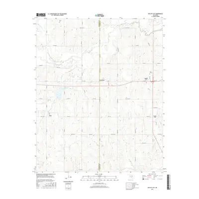
2016 Map of Ratliff City
USGS Topo · Published 2016About this map
The border between Stephens and Carter Counties defines this landscape in south-central Oklahoma, where small oil-country settlements and rural cemeteries are scattered across the watershed of Wildhorse Creek. Along State Hwy 7, the community of Ratliff City serves as a local hub, with its eponymous Ratliff City Cem located just to the north. To the west, the settlement of Countyline sits directly on the county boundary, while Alma and Pruitt City anchor the southern portions of the map. Genealogists can trace family sites at Alma Cem and the more remote Claude Cem in the north. The area is heavily marked by energy infrastructure, evidenced by roads like Mobil Rd, Getty St, and Sunray Rd. Hydrological features include the Wildhorse Creek Site 14 Reservoir and the winding paths of Caddo Cr and Panther Cr.
Find a feature on this map
51 named features on this map. Tap any name to fly to it.
Don’t see what you’re looking for? This feature index may not catch every label — zoom into the map to look around manually.
Map Details
Editions of this 2016 Ratliff City Map
This is the sole edition of this map. No revisions or reprints were ever made.
Other maps of this area

1898 · Pauls Valley
USGS Topo · 1:125,000

1901 · Addington
USGS Topo · 1:125,000

1901 · Ardmore
USGS Topo · 1:125,000

1902 · Pauls Valley
USGS Topo · 1:125,000

1902 · Rush Springs
USGS Topo · 1:125,000

1918 · Ardmore
USGS Topo · 1:125,000

1957 · Ardmore
USGS Topo · 1:250,000

1963 · Ardmore
USGS Topo · 1:250,000
1969 · Elmore City South
USGS Topo · 1:24,000
1969 · Tatums
USGS Topo · 1:24,000