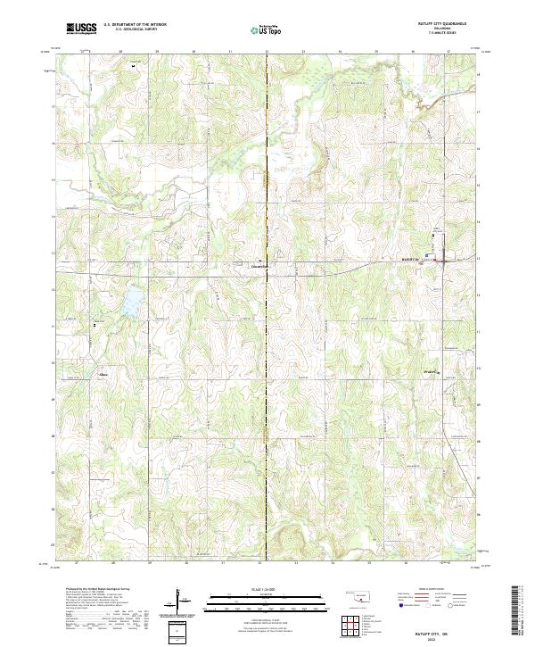
2022 Map of Ratliff City
USGS Topo · Published 2022About this map
The Stephens and Carter County border splits this portion of southern Oklahoma, where the oil-industry influenced settlements of Ratliff City, Alma, and Pruitt City sit among a landscape of creek drainages. The area is defined by its rural grid of roads, including Alma Rd and Old Hwy 7, connecting small family and community hubs. Significant local history is preserved at Ratliff City Cem, Alma Cem, and the more remote Claud Cem to the north. Waterways like Wildhorse Creek and Caddo Cr meander through the terrain, illustrating the natural drainage patterns of the region. The map captures the infrastructure of a working landscape, with numerous named routes such as Cargo Rd and Continental Rd serving the dispersed homesteads and industrial sites.
Find a feature on this map
55 named features on this map. Tap any name to fly to it.
Don’t see what you’re looking for? This feature index may not catch every label — zoom into the map to look around manually.
Map Details
Editions of this 2022 Ratliff City Map
This is the sole edition of this map. No revisions or reprints were ever made.
Other maps of this area

1898 · Pauls Valley
USGS Topo · 1:125,000

1901 · Addington
USGS Topo · 1:125,000

1901 · Ardmore
USGS Topo · 1:125,000

1902 · Pauls Valley
USGS Topo · 1:125,000

1902 · Rush Springs
USGS Topo · 1:125,000

1918 · Ardmore
USGS Topo · 1:125,000

1957 · Ardmore
USGS Topo · 1:250,000

1963 · Ardmore
USGS Topo · 1:250,000
1969 · Elmore City South
USGS Topo · 1:24,000
1969 · Tatums
USGS Topo · 1:24,000