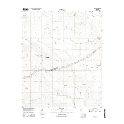
2015 Map of Ratliff
USGS Topo · Published 2015About this map
Twentymile Creek and its many tributaries, including Silver Br, Dugger Cr, and Yeager Br, define the landscape of this Northeast Mississippi region. The corridor of the Natchez Trace Pkwy and National Scenic Trail cuts diagonally across the center, following an ancient travel route through the settlements of Chapelville and Ratliff. For genealogists, the map is a dense record of community burial sites, from Pratts Cem in the north near Pratts to the Oak Grove Cem and Unity Cem in the southern reaches near Unity. The drainage patterns of Montachie Cr and Mantachie Cr reveal the varied topography where Lee, Prentiss, and Itawamba counties meet. Small rural crossroads are connected by an intricate network of county roads, such as Pratts Rd and Palestine Rd, which link the larger town of Baldwyn to the outlying agricultural areas.
Find a feature on this map
111 named features on this map. Tap any name to fly to it.
Don’t see what you’re looking for? This feature index may not catch every label — zoom into the map to look around manually.
Map Details
Editions of this 2015 Ratliff Map
This is the sole edition of this map. No revisions or reprints were ever made.
Other maps of this area

1921 · Booneville
USGS Topo · 1:48,000

1921 · Tupelo
USGS Topo · 1:48,000

1922 · Booneville
USGS Topo · 1:62,500

1923 · Tupelo
USGS Topo · 1:62,500

1956 · Tupelo
USGS Topo · 1:250,000

1958 · Tupelo
USGS Topo · 1:250,000

1965 · Mooreville
USGS Topo · 1:24,000

1965 · Fulton
USGS Topo · 1:24,000
1965 · Marietta
USGS Topo · 1:24,000

1965 · Kirkville
USGS Topo · 1:24,000