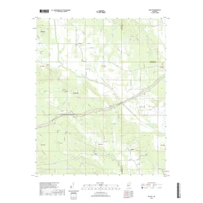
2018 Map of Ratliff
USGS Topo · Published 2018About this map
Ratliff and the surrounding northeast Mississippi landscape are defined by the convergence of Lee, Prentiss, and Itawamba counties. This area maintains a strong rural character, centered around historically significant small settlements and family burial grounds. The Natchez Trace Pkwy bisects the terrain, following the ancient corridor through the hills. Genealogists will find a wealth of site-specific data through the numerous cemeteries that dot the countryside, including Friendship Cem, Old Friendship Cem, and the Horton-Bailey Cem. A complex network of watercourses, such as Twentymile Creek and Mantachie Cr, shapes the local geography, while the smaller hamlets of Pratts, Unity, and Chapelville serve as the primary landmarks for local history research.
Find a feature on this map
109 named features on this map. Tap any name to fly to it.
Don’t see what you’re looking for? This feature index may not catch every label — zoom into the map to look around manually.
Map Details
Editions of this 2018 Ratliff Map
This is the sole edition of this map. No revisions or reprints were ever made.
Other maps of this area

1921 · Booneville
USGS Topo · 1:48,000

1921 · Tupelo
USGS Topo · 1:48,000

1922 · Booneville
USGS Topo · 1:62,500

1923 · Tupelo
USGS Topo · 1:62,500

1956 · Tupelo
USGS Topo · 1:250,000

1958 · Tupelo
USGS Topo · 1:250,000

1965 · Mooreville
USGS Topo · 1:24,000

1965 · Fulton
USGS Topo · 1:24,000
1965 · Marietta
USGS Topo · 1:24,000

1965 · Kirkville
USGS Topo · 1:24,000