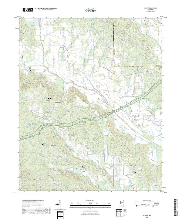
2024 Map of Ratliff
USGS Topo · Published 2024About this map
Twentymile Creek and Okeelala Creek define the drainage of this Mississippi landscape, which is marked by a legacy of rural crossroads and early travel routes. The Natchez Trace Parkway bisects the area diagonally, following the historic corridor that once connected the Tennessee River to the lower Mississippi. Small, long-standing settlements like Pratts, Chapelville, and Kirkville are scattered across the terrain, reflecting the agricultural and residential patterns of Lee, Prentiss, and Itawamba counties.
Find a feature on this map
102 named features on this map. Tap any name to fly to it.
Don’t see what you’re looking for? This feature index may not catch every label — zoom into the map to look around manually.
Map Details
Editions of this 2024 Ratliff Map
This is the sole edition of this map. No revisions or reprints were ever made.
Other maps of this area

1921 · Booneville
USGS Topo · 1:48,000

1921 · Tupelo
USGS Topo · 1:48,000

1922 · Booneville
USGS Topo · 1:62,500

1923 · Tupelo
USGS Topo · 1:62,500

1956 · Tupelo
USGS Topo · 1:250,000

1958 · Tupelo
USGS Topo · 1:250,000

1965 · Mooreville
USGS Topo · 1:24,000

1965 · Fulton
USGS Topo · 1:24,000
1965 · Marietta
USGS Topo · 1:24,000

1965 · Kirkville
USGS Topo · 1:24,000