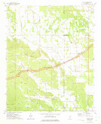
1973 Map of Ratliff
USGS Topo · Published 1975About this map
The Natchez Trace Parkway cuts across this section of northeast Mississippi, including a stretch marked as a proposed location during this early 1970s survey. The landscape is defined by the headwaters of numerous drainages, most notably Twentymile Creek and Mantachie Creek, which create a complex system of ridges and hollows. Small agricultural settlements like Pratts, Chapelville, and Ratliff serve as local hubs, each anchored by traditional country landmarks.
Find a feature on this map
35 named features on this map. Tap any name to fly to it.
Don’t see what you’re looking for? This feature index may not catch every label — zoom into the map to look around manually.
Map Details
Editions of this 1973 Ratliff Map
This is the sole edition of this map. No revisions or reprints were ever made.
Other maps of this area

1921 · Booneville
USGS Topo · 1:48,000

1921 · Tupelo
USGS Topo · 1:48,000

1922 · Booneville
USGS Topo · 1:62,500

1923 · Tupelo
USGS Topo · 1:62,500

1956 · Tupelo
USGS Topo · 1:250,000

1958 · Tupelo
USGS Topo · 1:250,000

1965 · Mooreville
USGS Topo · 1:24,000

1965 · Fulton
USGS Topo · 1:24,000
1965 · Marietta
USGS Topo · 1:24,000

1965 · Kirkville
USGS Topo · 1:24,000