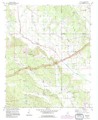
1992 Map of Ratliff
USGS Topo · Published 1995About this map
The Natchez Trace Parkway bisects this northeast Mississippi landscape, following a diagonal path through the converging borders of Lee, Prentiss, and Itawamba Counties. Small rural settlements like Pratts, Chapelville, and Ratliff anchor the road network, which winds around a complex system of drainage including Twentymile Creek and Mantachie Creek. The presence of numerous local congregations and burial grounds, such as East Mt Zion Ch and Peterson Cem, suggests a community structure rooted in small, family-centric locales.
Find a feature on this map
34 named features on this map. Tap any name to fly to it.
Don’t see what you’re looking for? This feature index may not catch every label — zoom into the map to look around manually.
Map Details
Editions of this 1992 Ratliff Map
This is the sole edition of this map. No revisions or reprints were ever made.
Other maps of this area

1921 · Booneville
USGS Topo · 1:48,000

1921 · Tupelo
USGS Topo · 1:48,000

1922 · Booneville
USGS Topo · 1:62,500

1923 · Tupelo
USGS Topo · 1:62,500

1956 · Tupelo
USGS Topo · 1:250,000

1958 · Tupelo
USGS Topo · 1:250,000

1965 · Mooreville
USGS Topo · 1:24,000

1965 · Fulton
USGS Topo · 1:24,000
1965 · Marietta
USGS Topo · 1:24,000

1965 · Kirkville
USGS Topo · 1:24,000