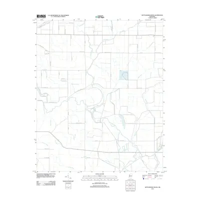
2012 Map of Rattlesnake Bayou
USGS Topo · Published 2012About this map
Quiver River meanders through this portion of the Mississippi Delta, defining a landscape dominated by complex waterways and agricultural drainages. The area is characterized by its numerous bayous, including the prominent Fighting Bayou, Dugan Bayou, and the namesake Rattlesnake Bayou. Small rural nodes like Livingston, Rattlesnake, and Richardson are connected by a network of plantation and county roads, reflecting the region's enduring agrarian structure. Cultural markers such as Cementary Rd and family-named thoroughfares like Doctor Richardson Rd and McCorkle Rd provide clues for genealogical research. The presence of Pee Dee Lake and Holeman Pond among the bayous illustrates the natural oxbow formations typical of the Delta's shifting river systems.
Find a feature on this map
62 named features on this map. Tap any name to fly to it.
Don’t see what you’re looking for? This feature index may not catch every label — zoom into the map to look around manually.
Map Details
Editions of this 2012 Rattlesnake Bayou Map
This is the sole edition of this map. No revisions or reprints were ever made.
Other maps of this area

1931 · Schlater
USGS Topo · 1:48,000

1931 · Sumner
USGS Topo · 1:48,000

1931 · Drew
USGS Topo · 1:48,000

1934 · Cleveland
USGS Topo · 1:62,500

1934 · Schlater
USGS Topo · 1:62,500

1935 · Sumner
USGS Topo · 1:62,500

1935 · Mound Bayou
USGS Topo · 1:62,500

1939 · Schlater
USGS Topo · 1:62,500

1939 · Sumner
USGS Topo · 1:62,500

1940 · Cleveland
USGS Topo · 1:62,500