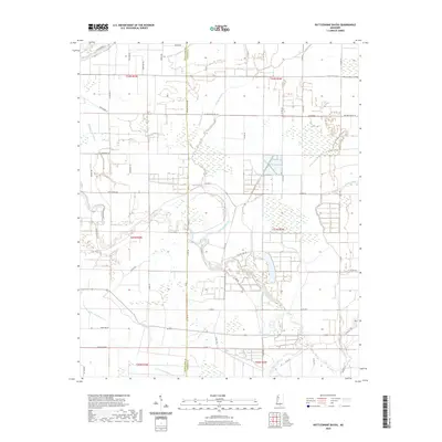
2020 Map of Rattlesnake Bayou
USGS Topo · Published 2020About this map
The Quiver River meanders across the rural landscape of the Mississippi Delta, defining the drainage patterns and historical land divisions along the border of Sunflower and Leflore counties. This contemporary survey reveals a complex network of waterways including Fighting Bayou, Dugan Bayou, and Rattlesnake Bayou, which crisscross the flat alluvial plain. The land is heavily partitioned by a grid of rural routes such as Quiver Rd and McCorkle Rd, illustrating a deeply ingrained agricultural heritage where family and community identifiers remain prominent. Notable local landmarks like Holeman Pond and several cemeteries accessed via Cementary Rd provide essential touchpoints for genealogical research. The presence of Walton Church Rd and W Walton Chapel Rd further underscores the area's social history, anchored by long-standing country congregations and rural intersections that have supported the local farming economy for generations.
Find a feature on this map
59 named features on this map. Tap any name to fly to it.
Don’t see what you’re looking for? This feature index may not catch every label — zoom into the map to look around manually.
Map Details
Editions of this 2020 Rattlesnake Bayou Map
This is the sole edition of this map. No revisions or reprints were ever made.
Other maps of this area

1931 · Schlater
USGS Topo · 1:48,000

1931 · Sumner
USGS Topo · 1:48,000

1931 · Drew
USGS Topo · 1:48,000

1934 · Cleveland
USGS Topo · 1:62,500

1934 · Schlater
USGS Topo · 1:62,500

1935 · Sumner
USGS Topo · 1:62,500

1935 · Mound Bayou
USGS Topo · 1:62,500

1939 · Schlater
USGS Topo · 1:62,500

1939 · Sumner
USGS Topo · 1:62,500

1940 · Cleveland
USGS Topo · 1:62,500