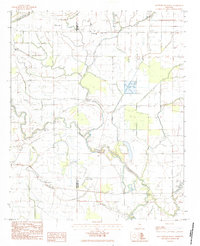
1983 Map of Rattlesnake Bayou
USGS Topo · Published 1984About this map
The delta lowlands of the Sunflower Co Leflore Co line are defined by a complex network of meandering waterways and drainage systems characteristic of this Mississippi region in the early 1980s. The Quiver River winds prominently through the landscape, flanked by smaller tributaries such as Dugan Bayou and Rattlesnake Bayou. This period of photography shows a landscape heavily managed for agriculture, where irrigation channels and elevated roads intersect the natural hydrology of oxbows like Cane Lake. The presence of the Neal Landing Strip in the northwest corner suggests the importance of crop dusting and aerial logistics in this rural farming economy, while the scattered dwellings and small bridges indicate a community deeply integrated with the river's path.
Find a feature on this map
7 named features on this map. Tap any name to fly to it.
Don’t see what you’re looking for? This feature index may not catch every label — zoom into the map to look around manually.
Map Details
Editions of this 1983 Rattlesnake Bayou Map
This is the sole edition of this map. No revisions or reprints were ever made.
Other maps of this area

1931 · Schlater
USGS Topo · 1:48,000

1931 · Sumner
USGS Topo · 1:48,000

1931 · Drew
USGS Topo · 1:48,000

1934 · Cleveland
USGS Topo · 1:62,500

1934 · Schlater
USGS Topo · 1:62,500

1935 · Sumner
USGS Topo · 1:62,500

1935 · Mound Bayou
USGS Topo · 1:62,500

1939 · Schlater
USGS Topo · 1:62,500

1939 · Sumner
USGS Topo · 1:62,500

1940 · Cleveland
USGS Topo · 1:62,500