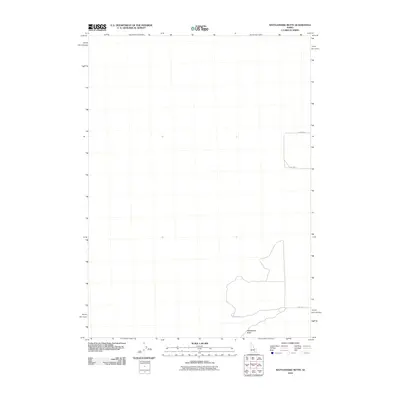
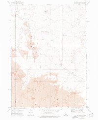
2010 Map of Rattlesnake Butte
USGS Topo · Published 2010About this map
Rattlesnake Butte anchors the southeastern corner of this high-desert landscape in Blaine County, Idaho. The 2010 survey highlights a largely undeveloped volcanic or basaltic terrain characterized by its distinct lack of dense settlement or surface water, emphasizing the isolated nature of the Snake River Plain. Human activity is represented primarily by a sparse network of unpaved access routes including Wapi Rd, Gehring Rd, and Rast Rd which skirt the edges of the volcanic fields. This edition serves as a clear record of the area's topography and road access at the start of the decade, showing the minimal impact of modern infrastructure on this specific portion of the Idaho interior.
Find a feature on this map
4 named features on this map. Tap any name to fly to it.
Don’t see what you’re looking for? This feature index may not catch every label — zoom into the map to look around manually.
Map Details
Editions of this 2010 Rattlesnake Butte Map
This is the sole edition of this map. No revisions or reprints were ever made.
Other maps of this area

1954 · Pocatello
USGS Topo · 1:250,000

1958 · Pocatello
USGS Topo · 1:250,000

1959 · Lake Walcott
USGS Topo · 1:62,500

1959 · Yale
USGS Topo · 1:62,500

1972 · Schodde Well
USGS Topo · 1:24,000
1972 · Rattlesnake Butte
USGS Topo · 1:24,000

1972 · Bear Trap Cave
USGS Topo · 1:24,000
1972 · Pillar Butte SE
USGS Topo · 1:24,000
1972 · Pillar Butte NE
USGS Topo · 1:24,000
1972 · Pillar Butte
USGS Topo · 1:24,000