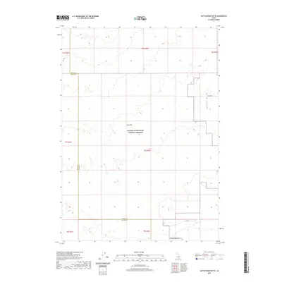
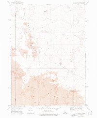
2020 Map of Rattlesnake Butte
USGS Topo · Published 2020About this map
Craters of the Moon National Preserve covers the central portion of this high-desert landscape on the border of Blaine and Power counties. The terrain is dominated by the volcanic legacy of the Wapi Flow, where lava fields created a distinct geological profile across the eastern Snake River Plain. In the southern reach of the map, the namesake Rattlesnake Butte rises as a prominent landmark near the intersection of several township lines. The eastern portion of the survey is characterized by the broad expanse of Pleasant Valley, which provides a flatter contrast to the surrounding volcanic formations. Infrastructure is sparse, limited primarily to remote access routes like Wapi Rd and Gehring Rd, reflecting the primitive and protected nature of this interior Idaho wilderness.
Find a feature on this map
8 named features on this map. Tap any name to fly to it.
Don’t see what you’re looking for? This feature index may not catch every label — zoom into the map to look around manually.
Map Details
Editions of this 2020 Rattlesnake Butte Map
This is the sole edition of this map. No revisions or reprints were ever made.
Other maps of this area

1954 · Pocatello
USGS Topo · 1:250,000

1958 · Pocatello
USGS Topo · 1:250,000

1959 · Lake Walcott
USGS Topo · 1:62,500

1959 · Yale
USGS Topo · 1:62,500

1972 · Schodde Well
USGS Topo · 1:24,000
1972 · Rattlesnake Butte
USGS Topo · 1:24,000

1972 · Bear Trap Cave
USGS Topo · 1:24,000
1972 · Pillar Butte SE
USGS Topo · 1:24,000
1972 · Pillar Butte NE
USGS Topo · 1:24,000
1972 · Pillar Butte
USGS Topo · 1:24,000