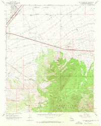
1968 Map of Rattlesnake Hill
USGS Topo · Published 1971About this map
The transition from the Hualapai Valley into the northern reaches of the Hualapai Mountains defines this 1968 landscape in Mohave County. In the north, the infrastructure of the Atchison Topeka and Santa Fe railroad and the Kingman Airport highlights the region's transport importance, while the southern terrain is marked by rugged drainage systems like Sawmill Canyon and Frees Wash. Ranching life is documented through scattered holdings such as the Lazy Yu Ranch, Shock Spring Ranch, and Getz Ranch, many of which relied on localized water sources like Berry Tank and various named springs and wells. The map also captures the early boundary of the Hualapai Mtn County Park, providing a detailed look at the interface between Mohave's high desert plains and its mountain recreation areas.
Find a feature on this map
33 named features on this map. Tap any name to fly to it.
Don’t see what you’re looking for? This feature index may not catch every label — zoom into the map to look around manually.
Map Details
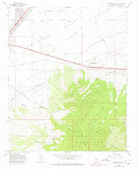
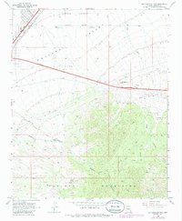
Editions of this 1968 Rattlesnake Hill Map
3 editions found
Other maps of this area

1886 · Diamond Creek
USGS Topo · 1:250,000

1886 · Camp Mohave
USGS Topo · 1:250,000

1892 · Diamond Creek
USGS Topo · 1:250,000

1892 · Camp Mohave
USGS Topo · 1:250,000

1939 · Chloride
USGS Topo · 1:48,000

1942 · Camp Mohave
USGS Topo · 1:250,000

1944 · Chloride
USGS Topo · 1:62,500

1947 · Kingman
USGS Topo · 1:250,000

1948 · Kingman
USGS Topo · 1:250,000

1948 · Williams
USGS Topo · 1:250,000