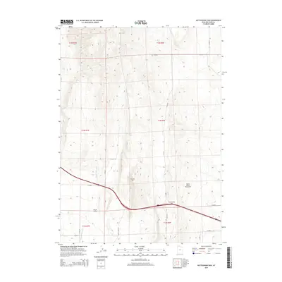
2014 Map of Rattlesnake Pass
USGS Topo · Published 2014About this map
Rattlesnake Pass serves as a critical topographic notch in this high-altitude landscape of Box Elder County. The terrain is dominated by the North Hansel Mountains, which overlook the broad expanse of Hansel Valley to the south and west. This survey details a network of rural routes, including N Hansel Valley Rd, that navigate the drainage of the Hansel Valley Wash. The dominance of the Public Land Survey System (PLSS) grid is evident through the township boundaries of t14n r6w and t14n r7w, illustrating the geometric parceling of this western rangeland. Prominent landmarks such as Franklin Hill provide orientation points within a landscape primarily shaped by intermittent watercourses and varying elevations.
Find a feature on this map
24 named features on this map. Tap any name to fly to it.
Don’t see what you’re looking for? This feature index may not catch every label — zoom into the map to look around manually.
Map Details
Editions of this 2014 Rattlesnake Pass Map
This is the sole edition of this map. No revisions or reprints were ever made.
Other maps of this area

1954 · Pocatello
USGS Topo · 1:250,000

1954 · Brigham City
USGS Topo · 1:250,000

1958 · Pocatello
USGS Topo · 1:250,000

1958 · Brigham City
USGS Topo · 1:250,000

1962 · Brigham City
USGS Topo · 1:250,000

1968 · Grover Canyon
USGS Topo · 1:24,000

1968 · Howell
USGS Topo · 1:24,000

1968 · Salt Wells
USGS Topo · 1:24,000

1968 · Ridgedale Pass
USGS Topo · 1:24,000

1968 · Rattlesnake Pass
USGS Topo · 1:24,000