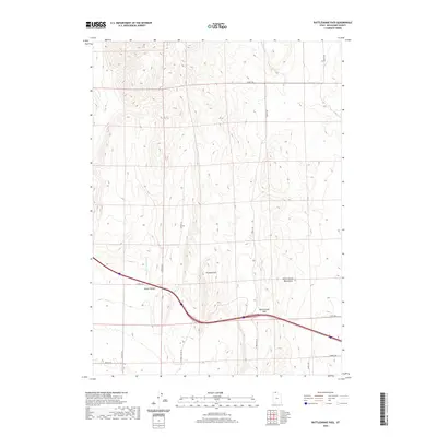
2020 Map of Rattlesnake Pass
USGS Topo · Published 2020About this map
Hansel Valley defines the core of this Box Elder County landscape, serving as a broad corridor between the North Hansel Mountains and western rises. The topographic relief is anchored by Franklin Hill, which overlooks the seasonal drainage of Hansel Valley Wash. This 2020 survey illustrates a sparsely populated region primarily organized by a rigid grid of rural connector roads, including N Hansel Valley Rd and 26400 N Rd. The most significant geographical feature is Rattlesnake Pass, a natural gap that facilitates east-west movement across the high desert terrain. The map's detail provides a clear view of the intersection between traditional land use and the modern transportation network, showing how the valley's topography continues to dictate the path of local infrastructure.
Find a feature on this map
17 named features on this map. Tap any name to fly to it.
Don’t see what you’re looking for? This feature index may not catch every label — zoom into the map to look around manually.
Map Details
Editions of this 2020 Rattlesnake Pass Map
This is the sole edition of this map. No revisions or reprints were ever made.
Other maps of this area

1954 · Pocatello
USGS Topo · 1:250,000

1954 · Brigham City
USGS Topo · 1:250,000

1958 · Pocatello
USGS Topo · 1:250,000

1958 · Brigham City
USGS Topo · 1:250,000

1962 · Brigham City
USGS Topo · 1:250,000

1968 · Grover Canyon
USGS Topo · 1:24,000

1968 · Howell
USGS Topo · 1:24,000

1968 · Salt Wells
USGS Topo · 1:24,000

1968 · Ridgedale Pass
USGS Topo · 1:24,000

1968 · Rattlesnake Pass
USGS Topo · 1:24,000