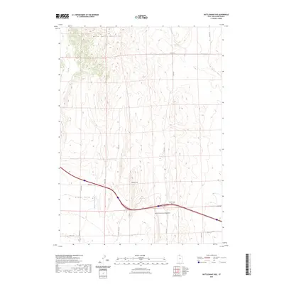
2023 Map of Rattlesnake Pass
USGS Topo · Published 2023About this map
The high desert corridor of northern Utah is defined here by the gap between the North Hansel Mountains and the North Promontory Mountains. This area centers on the strategic geographic notch of Rattlesnake Pass, a natural gateway for modern transportation following the same basic contours that once guided early travelers through the Great Basin. To the west, the broad Hansel Valley stretches out, drained by the seasonal Hansel Valley Wash, while the lone elevation of Franklin Hill stands as a landmark in the central basin. The mapping of N Hansel Valley Rd and various section-line routes like 26400 N Rd illustrates the grid-based approach to land management in this arid cattle and grazing territory.
Find a feature on this map
17 named features on this map. Tap any name to fly to it.
Don’t see what you’re looking for? This feature index may not catch every label — zoom into the map to look around manually.
Map Details
Editions of this 2023 Rattlesnake Pass Map
This is the sole edition of this map. No revisions or reprints were ever made.
Other maps of this area

1954 · Pocatello
USGS Topo · 1:250,000

1954 · Brigham City
USGS Topo · 1:250,000

1958 · Pocatello
USGS Topo · 1:250,000

1958 · Brigham City
USGS Topo · 1:250,000

1962 · Brigham City
USGS Topo · 1:250,000

1968 · Grover Canyon
USGS Topo · 1:24,000

1968 · Howell
USGS Topo · 1:24,000

1968 · Salt Wells
USGS Topo · 1:24,000

1968 · Ridgedale Pass
USGS Topo · 1:24,000

1968 · Rattlesnake Pass
USGS Topo · 1:24,000