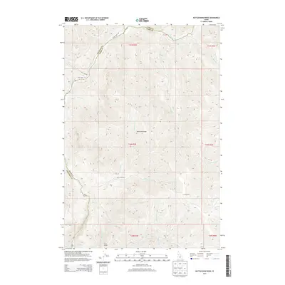
2013 Map of Rattlesnake Ridge
USGS Topo · Published 2013About this map
The Salmon River cuts through the northwest corner of this terrain, marking a deep boundary between Nez Perce and Idaho counties. This 2013 survey illustrates the remote, high-elevation ranching and range land of north-central Idaho, where development is limited to isolated outposts like the Flynn Creek Ranch and Camp Thomas. The landscape is defined by the massive spine of Rattlesnake Ridge, which serves as a drainage divide for numerous seasonal and year-round streams including Flynn Cr, Cottonwood Cr, and Rock Cr. Access to these steep canyons and high plateaus is maintained by rugged routes such as Eagle Creek Rd and China Creek Rd. The presence of several water sources, including Camp Thomas Spring and Thorn Spring, underscores the importance of water management in this livestock-oriented environment.
Find a feature on this map
34 named features on this map. Tap any name to fly to it.
Don’t see what you’re looking for? This feature index may not catch every label — zoom into the map to look around manually.
Map Details
Editions of this 2013 Rattlesnake Ridge Map
This is the sole edition of this map. No revisions or reprints were ever made.
Other maps of this area

1946 · Limekiln Rapids
USGS Topo · 1:62,500

1955 · Pullman
USGS Topo · 1:250,000

1955 · Grangeville
USGS Topo · 1:250,000

1958 · Pullman
USGS Topo · 1:250,000

1959 · Grangeville
USGS Topo · 1:250,000

1963 · Cactus Mtn
USGS Topo · 1:24,000

1963 · Deadhorse Ridge
USGS Topo · 1:24,000

1963 · Boles
USGS Topo · 1:24,000

1963 · Rattlesnake Ridge
USGS Topo · 1:24,000

1963 · Wapshilla Creek
USGS Topo · 1:24,000