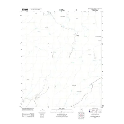
2011 Map of Rattlesnake Spring
USGS Topo · Published 2011About this map
Phillips Ranch and Frank Davis Ranch anchor the lower elevations of this high-desert landscape in Greenlee County, where the terrain rises toward the prominent heights of Sunset Peak and Brushy Mountain. The area is characterized by an extensive network of livestock water management features, including the High Mesa Tank, Buzzard Roost Tank, and Lambing Camp Tank, which support the remote ranching operations scattered throughout the canyons. Settlement patterns are sparse, defined largely by operational sites such as Silver Basin Corral and the Gap Holding Corral near Rattlesnake Gap. This 2011 survey details the rugged drainage systems of Rustlers Canyon and Black Jack Canyon as they feed into Lyda Creek, illustrating how water sources like Rattlesnake Spring and Gold Spring dictate the utility of the land for grazing and habitation in this corner of Arizona.
Find a feature on this map
52 named features on this map. Tap any name to fly to it.
Don’t see what you’re looking for? This feature index may not catch every label — zoom into the map to look around manually.
Map Details
Editions of this 2011 Rattlesnake Spring Map
This is the sole edition of this map. No revisions or reprints were ever made.
Other maps of this area

1902 · Clifton
USGS Topo · 1:62,500

1913 · Morenci
USGS Topo · 1:125,000

1915 · Morenci
USGS Topo · 1:125,000

1954 · Silver City
USGS Topo · 1:250,000

1954 · Clifton
USGS Topo · 1:250,000

1957 · Clifton
USGS Topo · 1:250,000

1958 · Silver City
USGS Topo · 1:250,000

1958 · Clifton
USGS Topo · 1:250,000

1959 · York Valley
USGS Topo · 1:62,500

1960 · Guthrie
USGS Topo · 1:62,500