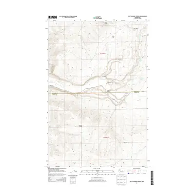
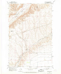
2014 Map of Rattlesnake Springs
USGS Topo · Published 2014About this map
Dry Coulee and the surrounding high plateau of Central Washington dominate this 2014 survey along the boundary of Douglas and Grant Counties. The landscape is defined by deep geological incisions and vital water sources in an otherwise arid environment, anchored by Rattlesnake Springs and the nearby Mineral Spring. The presence of several other watering points, including Bell Spring and Bowers Spring, suggests the critical importance of these features for local ranching and transit across the coulees.
Find a feature on this map
31 named features on this map. Tap any name to fly to it.
Don’t see what you’re looking for? This feature index may not catch every label — zoom into the map to look around manually.
Map Details
Editions of this 2014 Rattlesnake Springs Map
This is the sole edition of this map. No revisions or reprints were ever made.
Other maps of this area

1953 · Ritzville
USGS Topo · 1:250,000

1956 · Ephrata
USGS Topo · 1:62,500

1956 · Ephrata SW
USGS Topo · 1:24,000

1959 · Ritzville
USGS Topo · 1:250,000

1965 · Ritzville
USGS Topo · 1:250,000

1965 · Jameson Lake SW
USGS Topo · 1:24,000
1966 · Monument Hill
USGS Topo · 1:24,000
1966 · Palisades
USGS Topo · 1:24,000
1966 · Rattlesnake Springs
USGS Topo · 1:24,000
1966 · Appledale
USGS Topo · 1:24,000