
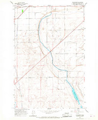
1956 Map of Ephrata SW
USGS Topo · Published 1957About this map
The rugged Beezley Hills dominate this mid-century survey of Grant County, illustrating a landscape defined by the arrival of massive irrigation infrastructure. To the north, the upland Sagebrush Flats and Wheatland Road trace a territory of dryland farming, marked by the site of the Wheatland School (Aband). This upper plateau gives way to a complex network of water management features in the southern lowlands, where the West Canal and Great Northern Canal cut across the terrain alongside a Wasteway and an engineered Siphon. The small settlement of Winchester sits at the southern edge of the sheet, positioned along the Great Northern railroad. The presence of a Pumping Station, Water Tank, and Dam near the rail line highlights the industrial scale of the Columbia Basin Project's transformation of the Washington desert into a fertile agricultural corridor.
Find a feature on this map
26 named features on this map. Tap any name to fly to it.
Don’t see what you’re looking for? This feature index may not catch every label — zoom into the map to look around manually.
Map Details
Editions of this 1956 Ephrata SW Map
This is the sole edition of this map. No revisions or reprints were ever made.
Other maps of this area

1909 · Quincy
USGS Topo · 1:62,500

1910 · Quincy
USGS Topo · 1:62,500

1910 · Winchester
USGS Topo · 1:62,500

1953 · Ritzville
USGS Topo · 1:250,000

1956 · Ephrata
USGS Topo · 1:62,500

1956 · Ephrata
USGS Topo · 1:24,000

1956 · Winchester NE
USGS Topo · 1:24,000

1959 · Ritzville
USGS Topo · 1:250,000

1965 · Ritzville
USGS Topo · 1:250,000
1966 · Winchester
USGS Topo · 1:24,000