
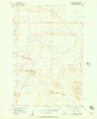
1956 Map of Winchester NE
USGS Topo · Published 1957About this map
Agricultural and aeronautical infrastructure define this mid-1950s landscape in Grant County. The area is marked by a complex system of water management, including a prominent Wasteway and multiple Canal segments like the W-20 that supported the region's developing irrigation needs. This survey reflects a period of modernization where the traditional White Trail Road and Morrison Road intersect with newer utility corridors like a major Pipeline. High-elevation landmarks such as VABM Blythe 1360 provided critical reference points for surveyors, while the Ephrata Radio Range Station and an Airway Beacon signify the area's importance to regional aviation routes. The map provides a detailed view of the terrain's transition, evidenced by several dry wells and the extensive network of earthen structures like the Levee protecting these low-lying lands.
Find a feature on this map
15 named features on this map. Tap any name to fly to it.
Don’t see what you’re looking for? This feature index may not catch every label — zoom into the map to look around manually.
Map Details
Editions of this 1956 Winchester NE Map
This is the sole edition of this map. No revisions or reprints were ever made.
Other maps of this area

1910 · Winchester
USGS Topo · 1:62,500

1912 · Moses Lake
USGS Topo · 1:62,500

1953 · Ritzville
USGS Topo · 1:250,000

1956 · Ephrata
USGS Topo · 1:62,500

1956 · Ephrata
USGS Topo · 1:24,000

1956 · Ephrata SW
USGS Topo · 1:24,000

1956 · Grant Orchards
USGS Topo · 1:24,000

1956 · Mae
USGS Topo · 1:24,000
1956 · Winchester SE
USGS Topo · 1:24,000
1956 · Moses Lake NW
USGS Topo · 1:24,000